Showing posts with label urban. Show all posts

Friday, June 17, 2011

The Last Post


It has been many week since I have written a post. This is due to a variety of reasons.

I am currently working as an intern at the United States Senate. I am involved in variety of projects and activities related to a variety of topics. My primary focus has been active transportation in relation to obesity prevention.

I will no longer be posting in this space because this space no longer has the capacity to reflect my current and full views.

I was initially attracted to writing on the topic of "Urban Transport Revolution" (or initially as "Transportation Solutions from a Burqueño") as a result of trying to follow the ideas and concepts of the existing Streetsblog community. Having an existing blogging network to join seemed much easier than trying to create a following from scratch. While this concept worked well for awhile, it eventually led to posts which were too focused on urban transport related issues vs. larger concepts that I wanted to cover.

I love the Streetsblog community and I find it wonderful. However, I personally want to explore some broader concepts related to transportation, urbanism, history, built environment, government and community. Since the title "Urban Transport Revolution" fails to cover all those bases, I can not post here anymore. The current title also alienates many parties that i would like to appeal to. I have changed the name of this blog too many times already; another name change would be defeating to my overall purpose of this space, as well as make it inconsistent with previous posts in this space.

KEY POINT: I will no longer be posting consistently here. HOWEVER, once I have a better idea of what I want to write about, I will begin writing again, on the Wordpress platform. Once I figure out the logistics of that, I will post the link to my new web log here.

Thank you for reading! Though I will not be posting here anymore, emails, comments and questions are always welcome.

Dan M.

Sunday, May 22, 2011

Free Spaces Make for Protest Places


Gathering space for people is important for human society. Take the example of Puerta del Sol in Madrid, Spain.

I spent a fair amount of time in this incredible space just a few months ago. It is truly the Sol ~ soul of the entire country. Every road radiates outward from this point to places all over Europe. It is the center of everything in Spain. Read more about it here.


In the late 2000's, this site, which had been a busy vehicle filled transportation hub, was converted into a mostly car fee space. The transportation has all been moved underground. It is now THE gathering spot of Madrid, as well as the rest of the country.

"Gathering" also sometimes includes protest. This is fantastic. Having a space where people can gather peacefully and safely in large numbers is crucial to a functioning democracy. We all saw how important this was in Egypt with Tahir Square. We also saw how it all plays out when democracy doesn't exist: China, Tiananmen Square, 1989.

Humans have always gathered. It used to be over a campfire but it has changed quite a bit over time.

Watch the live feed below. As of this posting, it shows the occupation of Puerta del Sol in Madrid. How it all plays out will only be known over time. Twitter has played a role but overall, it's space, place and people.


Free live streaming by Ustream

Monday, March 7, 2011

The Central Avenue Corridor, Albuquerque, NM


In my GEOG 416E geovisualization class, we recently completed a lab. The premise of this lab was based on comparing the properties of Google Map/Google Earth vs. ArcGIS as geovisualization tools. For my project, I decided to do a cultural and spatial interpretation of the Central Avenue corridor in Albuquerque from a urban planning perspective.

Here is the result:

View Albuquerque's Central Ave. Corridor in a larger map

If you click on the "View Albuquerque's Central Ave. Corridor in a larger map" link, you can gain a better sense of the context of the route. I put place marks along the route on intersections I felt were relevant to the history of Albuquerque. Each of the place marks contain some sort of information about that specific intersection and its relevance.

My main goal with this lab was to show all the different types of land uses that exist along Central. One important aspect of this is the fact that Central used to be a part of Route 66, a historic highway that traveled from Chicago to Los Angeles before the interstate system was constructed. Much of modern day Interstate 40 = old Route 66.

My main motivation for creating this map was my memory of a round table discussion I attended last summer in Albuquerque. A large diverse group of stakeholders gathered in a downtown Albuquerque hotel to discuss the future of the Central corridor. Our primary reason for gathering was the desire to acquire a federal TIGER grant. The grant was to fund transportation and land use improvements along this vital and historic corridor.

After a few meetings, however, it became clear that moving in one single direction would be challenging. This makes sense, as Central is quite possibly one of the most diverse single corridors in the United States. It includes Downtown, Old Town (top tourist attraction), UNM (major university), Nob Hill (art district), the State Fairgrounds and much more.


A conclusion was never reached but the discussions stuck with me.

One group in Albuquerque, The Zipper, has tried to address the diversity of this corridor. They have marketed the Central corridor as a unique and fun place to shop, live and explore. Though they only address a portion of this amazing corridor, they should definitely be included in the process of developing this corridor in the future.

So now I have created this map. I wonder: would the existence of this map benefited the planning process? The ability to visualize place in a project can be quite valuable in these situations.

Look at my map. Click on the place markers. Is it user friendly? Is it educational? Let me know.

Thanks for reading!

Thursday, January 20, 2011

Recent Developments: Back in Tucson and the Living Streets Alliance


NOTE: This was a post I had started a few months back before spring semester commenced. Since then, things have become infinitely more busy. However, now I have a better idea of the direction I want to move in. This post is a combination of the old material I had previously written and newer updates on my life.

---

It has been a long while since I last posted. This is due to the fact that I have been traveling around various countries in Europe. I was traveling for a few weeks and I saw some incredible European cities.


I had previously read extensively about many of the countries I visited. However, physically visiting these places was an entirely different and wonderful phenomenon. I was able to see, first hand, how a city could be organized around bicycle transportation (Amsterdam, among many others). I saw how high speed rail has become the new normal in Europe and changed the face of long and medium distance travel for the better (Germany, among others). I was able to easily walk or take public transit to every destination I desired everywhere I went.

It was truly wonderful.


Returning to Tucson, AZ for the spring semester I am now involved with sustainable transportation on the local level. Currently, I am working with the Living Streets Alliance.

As of late, I have decided my new career focus is education and advocacy.

---

Newer material; written 2/28

In the vein of education being my newest interest, I recently became a bike ambassador for Pima County. This means that I will be participating extensively in bike events (such as the upcoming Tucson Cyclovia) as well as assisting with other bike education and safety programs.


Another interesting development recently occurred as well. A prominent local bike blog, Tucson Velo, held a letter writing contest. This contest stated that everyone should write letters to the mayor encouraging him to vote against the proposed city zoning code revision that would decrease the accessibility and quality of bike parking in the city.

I ended up writing a letter, which was published on Tucson Velo. When this occurred, a local news woman, Larrisa Wohl, decided she wanted to interview me for a weekly news segment called "2 Wheelin' in Tucson".

Today I was interviewed for this story. I will be posting the video segment as soon as it is released.

On a more local level, I am currently living at 1st Ave. and Linden St. This is in close proximity to the 4th Ave./Fontana bike boulevard currently under construction. The completion of this facility will profoundly affect my neighborhood, as it connects many portions of the denser urban portions of Tucson with each other. Overall, this is a very positive development and I look forward to its completion towards the end of the spring semester.

As previously mentioned, I am very involved with the Living Streets Alliance. I am now an official board member as well. I have met many incredible people through this group and I continue to make many great connections.


Now, the blog itself.

I definitely want to continue blogging. I am currently planning on developing some different blogs with a wider variety of topics. I have changed the theme of this blog too many times to justify continuing with it in the long run. However, until I start those other blogs, I will continue to use this blog as my primary platform for updates on my life and work.

Thursday, October 14, 2010

New Title, New Vision, New Ideas


Here I am, back again.

I have not written in a very long time. This is due to the fact that I am in España (Spain)! I will be in Europe until early January and then return to the University of Arizona for one and a half more semesters.

The first item I would like to address is a project I have been working on with Parking and Transportation Services at the University of Arizona. Last year, I noticed an interactive map on the PTS website. It had some neat features, such as traces for various buildings on the campus, maps of parking zones and CatTran routes. However, the map left me wanting more transportation information, especially for SunTran, the Tucson city bus.

I visited PTS and talked to the person who created this map. He liked my ideas so much that he decided I should add the things I wanted to the map! How about that for innovative collaboration?

Though I made quite a few changes, the major ones were adding more SunTran stop icons (all stops within close vicinity of the U of A campus) and adding stop information to all of the stops (both SunTran and CatTran). Also, this map is now linked directly to the U of A home webpage. Here is the current live version of the map as it exists now. I am now listed as a collaborator. Though I have more ideas about things to add, I will wait until next semester to address them.


So, back to the title of this post.

New Title: I decided to change the title of this blog (yet again) to "Urban Transport Revolution: Ideas for a More Intelligent Future". Why the name change?

The new name is more broad because my posts and ideas have become more broad. Though I am primarily interested in transportation, I am also interested in EVERY facet of urban life.

In addition, transportation does NOT exist in an isolated bubble; its success or failure depends on a huge variety of factors, with walkabiltiy being a huge part of the equation. Changing the current paradigms of American transportation policy will truly require a revolution. Though some cities and states are beginning to understand the work necessary, there is a long struggle ahead of us.


New Ideas: Maybe there are not new, but they are important.

Walkable mixed-use density = successful transit. This equation may look simple, but it is incredibly complicated. Some think density is the primary factor in transit success, but it's only one part of the equation. If these dense areas are:

a) dense single use and not mixed use (miles of apartment buildings without a grocery store)
OR
b) dense and not walkable (divided up by lots of fences, walls, major busy streets, etc.)
OR
c) walkable but not dense (dense is a vague quantifier, but basically anything with only single family homes)
OR
any other combo, transit is not guaranteed success. Sure, there are a few examples of these outlier patterns leading to quality transit ridership, but they are not easy to find.

Jarrett Walker, in his blog Human Transit, goes into these issues with more depth.

Once the governments controlling the cash understand the connections between all these things (plenty of other people [PDF] already do), the revolution can begin.

Anyway, that's all for now. Hopefully, I will be posting more often now.

Ciao!

Wednesday, September 1, 2010

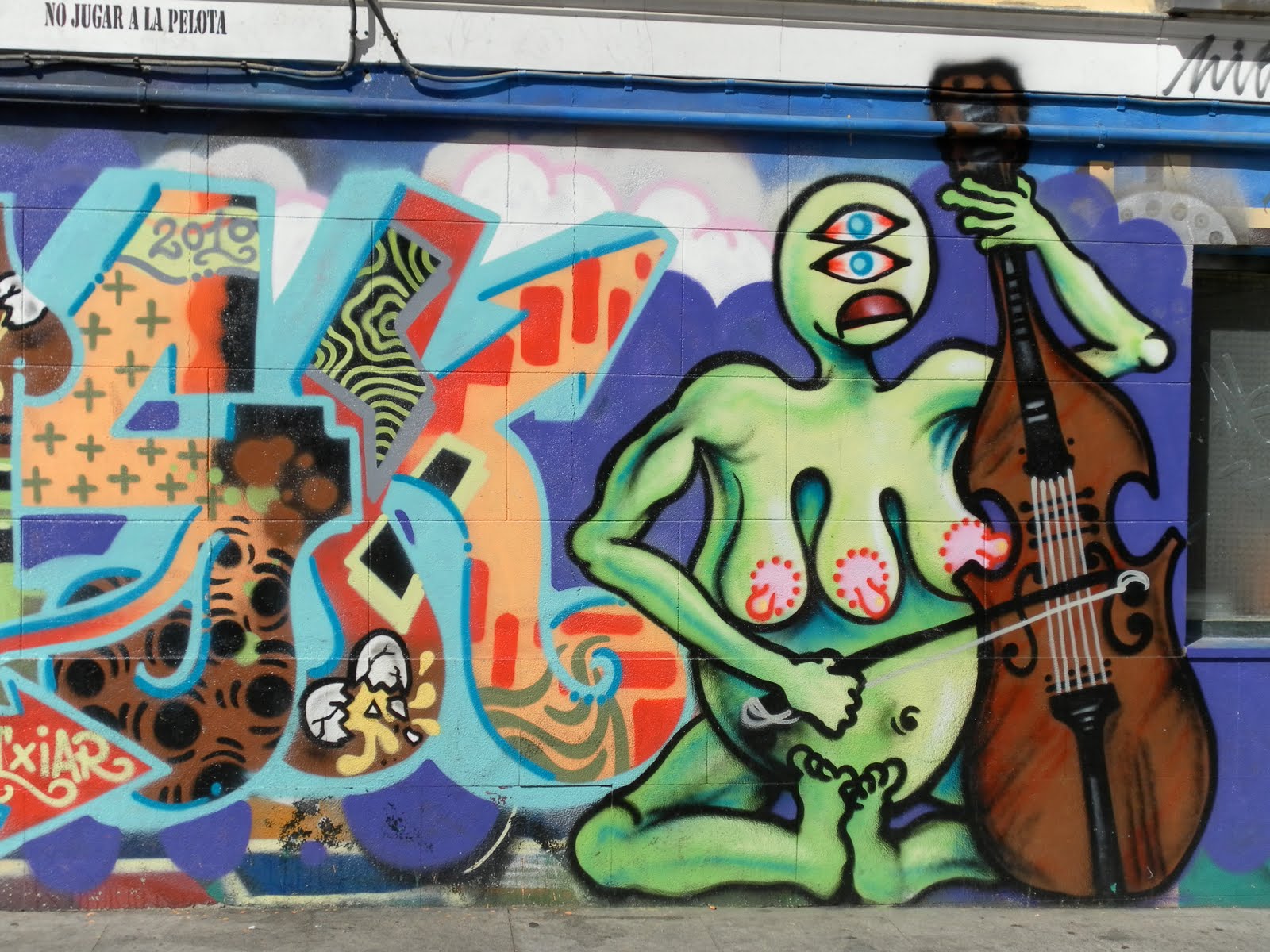
ART or GRAFFITI?


I have just completed my short five day stay in Madrid, España and am now in Alcala de Henares to begin my actual studies.

Though I usually write about transportation, I am interested in anything remotely related to urban form and development and this topic is definitely related.

During my adventures through Madrid (by foot and by Metro), I noticed a large amount of paint on the walls of the buildings around me. Some of it was quite ugly and would be considered vandalism by most:


Other examples were more colorful, but would be considered "tags" by many:

However, a "tag" is a pretty negative term to describe the colorful work posted above.

There were many pieces that had tags on top of art on top of tags and onward. Everything became a multilayered piece of work:


And then there was this piece. It is obviously a tag but it made me laugh (value of positive emotional response) due to the resulting geographical juxtaposition of a boutique clothing store + the symbol of anarchy:


Then there were the residents/store owners: some mornings, they would be cleaning the scribbled text off the walls in front of their storefronts. Other retail establishments seemed to embrace the work done on their facade, or maybe they encouraged it in the first place. The store I saw with the most creative solution had a portion of their sign that said "Please do all graffiti here" with an arrow to a portion of the wall.

In the end, this entire situation leads to a question: How do authorities and governments pursue the issue of "street art"? Do they promote some of it and condemn other parts of it? Who makes that judgment call about what should stay and what should not? Does allowing paintings on buildings lead to "taggers" thinking they can mark the walls of the city as well? How much money is the Madrid police spending every year to "clean up" the ugliest of the tags?

In these specific neighborhoods (specifically Malasaña and Chueca), there seemed to be a good balance of the authorities respecting what looked like art and cleaning up the uglier tags.

In my personal opinion, the street art really enhanced the neighborhood. The vivid colors really brightened the narrow streets. It provided me with insight and perspective about the residents of the area. In addition, it helped me to understand the culture in existence without going inside a single residence.

However, I do not live in these neighborhoods; I am simply a visitor. I have a feeling a lot of the residents hate the graffiti, especially the older residents. I also thought about my parents house in Albuquerque; my parents would probably be appalled if any of these colorful forms of expression started popping up in upper-middle class Glenwood Hills.


This whole discussion goes back to the events that occurred just a few weeks ago in Albuquerque.

A few months ago, this beautiful piece of work popped up on the side of a Downtown building.

A couple more similar works popped up around town, but no one talked much about it. The small amount of local discussion I heard about it (through the comments on this post) was mostly positive (Why can't he paint my house?).

Then, the artist, nicknamed the "Rainbow Bandit" for his colorful pieces of self expression on private property, was arrested by APD. This occurred days after a great anonymous interview about him ran in a local "alternative newspaper" called the Alibi.

While I understand the motivation behind his arrest, I have no idea why APD was focusing on him. There are so many other taggers in the ABQ metro area that do some really ugly, crappy work. His colorful drip paint rainbows all over town were beautiful; one of them appeared on a post-crash half-build ugly skyscraper, making this eyesore that much prettier.

So, art or graffiti?

Sunday, July 11, 2010

The Layers of NYC


Yesterday, I spent the day touring New York City. I saw many interesting bits of urbanism, from the World Trade Center construction site (which, after years of delays, is finally being reconstructed) to the High Line (an old raised urban railroad that has now been turned into a spectacular park/public space).

New York City is a place like no other, especially in the context of America. Its density and population is unrivaled by any other urban area in these United States. It's transit system is not only extensive, but it is also used by a majority of the population. The city has recently received positive attention from the urban planning world as a result of the new planning director in NYC Janette Sadik-Khan. Her new policies on creating bike friendly and pedestrian friendly infrastructure have caught the eye of planners across the globe.


When I visit places like NYC, I try to figure out what exactly makes the city such an interesting and desirable place, both to live in and to visit. Parts of the answer may be obvious (such as Central Park), but some aspects of the city seem like true turn-offs. The streets are filled with speeding, stinky cars. The subway stations are old, dirty and hot. The traffic is terrible, and it is almost impossible to find one peaceful, quiet spot in the entire city.

So why go?

For people who live there, the simple answer might be employment. But in my opinion, time is the thing that truly makes this place fascinating.

Since people have been living on this little island for such a long time, layers and layers of culture, history and urbanism have been created over time. One could walk for 3 blocks and hear 20 different languages, We were sung to by an African-American trio on the subway (they were pretty talented). There were 4 different bands playing at one single relatively small park we visited (Washington Square Park).

This kind of culture can not be created overnight.

The people who argue about the urban/surburban divide never touch on the issue of time. Cities are usually more interesting places than suburbs simply because the cities have existed for a longer amount of time.

Mix of use is also incredibly crucial. When buildings have a mix of uses (basically residential + anything else) they allow people more options about where they live and work. This allows for a variety of transportation options: walking, biking, roller-blading, skateboarding, bus riding, train riding or even automobile driving. People are always clamoring for more options in life; auto dependent development does NOT provide many options.

Overall, time has led to the creation of city filled with layers. It has layers of culture and layers of infrastructure. It is an organically growing place with constant movement and evolution. Some call it the City that Never Sleeps. What allows the city to stay awake all night?

One important aspect of that is the 24/7 subway network. When you have a transportation network running all day and all night, people will use it all day and all night. This is especially true in a city such as NYC, which has high density and a robust diverse economy.


How can we create incredible places such as NYC? Time is one very important ingredient.

A great public transportation network also helps.

Monday, July 5, 2010

Beantown: Urban Form and Function


Density: The part of Boston I am staying in (Back Bay) is quite dense, especially compared to the rest of the United States. This makes sense as Boston is one of the oldest American cities. It is also very diverse and educated, being home to a massive number of universities.

The city itself is different from many of the other older American cities (Philadelphia, NYC, Wash. DC) because it is not planned on a grid system. Its streets are chaotic and ancient, creating an interesting urban area with many urban layers. Much of the current city is also built on landfill, causing adjacent neighborhoods to be sometimes completely different.

As with most major American cities, Boston went through a serious decline/ urban renewal process a few decades ago. This led to the construction of some notoriously ugly modernist buildings (Boston City Hall). However, many locations that recently were open lots/surface parking have been transformed into lofts and other new/New Urbanist developments. A major project, called the Big Dig, recently covered a major freeway with a park. Though this project has been beneficial, some residents are unhappy about the quality of the new public space and the price of the project. However, it is really encouraging to see this city recovering from a period of serious urban decline. This success is in no small part due to the previously mentioned large number of universities.

All of this information goes to the back of my head as I witness an urban battle over space occur in Boston: cars vs. everything and everyone else.

This is not a new battle; it is constantly occurring everywhere. It happens to be especially fascinating to witness in Boston due the contrast of an ancient city and a relatively modern freeway network.

As recently mentioned in this Streetsblog video, the city of Boston is quickly becoming more bike friendly. It is astounding that this city was previously bike unfriendly (did I mention how many universities are located here?!?) and the city continues to have plenty of elements of a bike unfriendly city. Looking out my hotel window, there are encouraging symbols of the future to come, with brand new bike lanes, sharrows and bike boxes all visible from my room.

Just yards away form hotel exists a major freeway. This freeway is surrounded by properties in continual decline and areas that feel dangerous at night. The continual negative externalities of a surface freeway system continue to haunt many once beautiful Boston neighborhoods. Cars continue to speed by on wide urban arterials. Drivers continue to ignore pedestrians and bicyclists. Car sharing vehicles (Zipcar, etc.) are rarely if even seen, and a bike sharing network that was supposed to be up and running is nowhere to be found. Suburban style development rubs elbows with historic neighborhoods. Some metro stations are found outdoors under double tiered freeways, creating a dangerous and unfriendly pedestrian environment. Others are found in dark, old dirty tunnels, filled with squeaky trains that frequently break down.

How do we want to develop our cities? What do we want our future cities to look like? How much sense does it make to continue heavy subsidies for a network that depends upon finite fuels and massive amounts of valuable real estate?

It's time for a transportation revolution.

Back At It from Urbanquerque


After not posting for over one month, I am trying to get back into it. I have had so many ideas and adventures that it has been hard for me to figure out how to turn them into some sort of written form. Alas, without trying there would be no success.

My living situation for this coming month is urban and unique: I am spending the month living yards away from the University of New Mexico (UNM) in a 1950's style suburban house in the Nob Hill neighborhood. My reasons for living down here are
a) my downtown summer job at ABQ Ride and
b) the fact that I am starting summer school tommorrow at UNM. I have no car for the summer so living in the far eastern part of theNE Heights with my family would be impractical.

The cost of living here in Albuquerque is extremely cheap. Since I am living so close to transit and bike-friendly areas, my transportation costs are ZERO. This is due to the fact that I am working at ABQ Ride this summer (they provided me with a free bus pass) and the fact that my father is letting me borrow his fantastic old-skool road bike.

My quality of life down here is amazing. I bike pretty much everywhere and go on long bike rides every evening as the sun sets and the earth cools down. I buy groceries (mostly from the nearby Sunflower Market) and cook almost all my own food, saving lots of cash. Basically, my only expenses are rent and the occasional grocery trip.

Most people believe that living carfree in burque is impossible; I am proud to say that it is entirely possible (in certain parts of the city) and continues to get easier.

Tuesday, May 4, 2010

Power to the People: Take Power from the States and Give It to the CITIES!


Today, I came across this great article from the site Next American City.

The article basically discusses the problem with federal money being distributed to state governments:
Indeed, the strength of state governments in making transportation decisions is one of the primary culprits for the highway-dependent state of the American landscape, in addition to the federal urban renewal policies and Interstate Highway legislation that are more typically singled out for blame. This fact comes to the serious detriment of metropolitan areas, which lack the fiscal ability and legal right to make full decisions about their transportation futures.

Why does this occur?
That’s because the politics of almost every state are dominated by rural and suburban constituents, or, in other words: car drivers. The urban transit users, pedestrians, and bike riders are typically at the back of the pack when it comes to representation.

The author of the article, Yonah Freemark, calls on Washington to "stem that state power". However, he offers no alternative way for distributing federal money. He seems to be in favor of the Feds having more power in distributing the money.
This issue is also covering in this blog.

I agree with Mr. Freemark: urban areas should have far more power. Money should not even be funneled in to the Feds in the first place; more tax money should be staying within localities. The amount of money each locality has would be based on the amount of economic activity occurring in each given metro area. In the case of money being distributed from a Federal level, it should work the same way: the more valuable the metro area to the economy, the more money it gets.

However, since I am talking about this issue purely from a transportation standpoint, I can see many problems with money being distributed in this manner. Since everything is so road and highway oriented, how could anyone guarantee all the money would not just be used for building new highways?

One solution could be the idea of Federal matching of funds: the more money localities would contribute to non-road projects, the more money would be provided by the Feds for transportation.

Overall though, the main point:
The Feds can not just keep throwing money at states for whatever transportation projects they want. State governments will continue to prioritize road and highway projects because that is the popular thing to do in many jurisdictions (especially the rural ones).

Let the majority be represented. Give urban areas far more political power.

Update (5/8): Here is another blog that discusses this very issue. It suggests giving the power to MPO's (Metropolitan Planning Agencies). All metro areas with a population above 50,000 are required to have MPO's, so it makes sense to distribute federal money through these organizations. In Albuquerque, the MPO is MRCOG, and in Tucson the MPO is PAG.

These groups do a lot of regional transportation planning, so it makes a lot of sense to give these agencies more money, and power.

Update 5/12: Here is great article about the history of road funding. It discusses how the acceleration of the car based transportation system led to money being taken from local control and given over to state and federal control. This [PDF] is the longer article that this previously linked article was summarizing.

We MUST focus on getting our transportation money back to the local authorities. State leaders generally do not understand the idea of "sustainable transit". Metro regions do and they need the money now, more than ever, to invest in sustainable transportation options.

Thursday, April 22, 2010

Cyclivia in Tucson: The Posibilities for the Future

This past weekend, Tucson had its first cyclovia event.


On Sunday, from 10 AM until 2 PM, four sections of different streets were closed off to automobile traffic, freeing the streets for non-motorized activities for miles. This page has more information, and this blog has a good write up of the event.

The purpose of a cyclovia is to allow all uses other than automobiles on the streets. The problem with doing this in Tucson is the quality of the pavement. Most sections of the route were not smooth enough to allow for skateboarding, long-boarding, roller blading and other activities that require smooth pavement. This is unfortunate because some members of the community really enjoy these activities and would love to have an entire street to participate.

Overall though, it is hard for me to be pessimistic about this event. There were a lot of people out participating and interacting with the built environment in a more sustainable way. When people move more slowly through a place, they can interact with it better. They can see how bad of condition the streets are in and contact the city, demanding improvement. They can find neat restaurants and cafes they never previously noticed.

The best thing about cyclovia is taking street space away from cars. Though it was only for 4 hours on one day of the year, it represented an opportunity to take back the streets. For too many years, American transportation policy has dictated that cars are the only way to get around efficiently.

This is simply not true. Plenty of places in America are easily accessible by foot, bike or transit.

For the places that are not yet accessible,efficient land use policy can help to change this unfortunate reality.


It is also telling that much of this cyclovia route will soon be home to the route of Tucson's first modern streetcar. Construction will begin this fall (Oct./Nov. 2010), and according to project managers, the project will be complete in about 15 months. This means that next year on April 18th, the cyclovia route will look very different.

In five years, the route will probably be very different as well. Construction on the streetcar will have been completed for a long time. Development will probably be occurring along the route, and the recession will hopefully be far over.

However, the real question should be what will the first Tucson cyclovia route look like in ten years? Only time, and progressive planning policy, will tell.

Sunday, April 11, 2010

The Urban Solution vs. the Rural Solution: The Internal Conflict Within the Green Movement

When environmentalists talk about the sustainability/green movement, many times you hear two different solutions:

Solution #1
One side discusses the benefits of urban density. Everyone must live in dense walkable areas that stimulate community connectivity. We need to reduce automobile dependence by living close to most of our daily services and ideally, close to our jobs as well. This is the best and most logical solution to our current problem.

Solution #2
The other side uses terms such as "locavore" and "permaculture". This side discusses the benefits of everyone producing their own food. Everyone should have a beehive, three chicken and a vegetable patch in their backyard. Everything you eat, or possibly even use, should be produced within ten miles of your home. Native plants and animals can and should be utilized for food, instead of exotic and foreign plants and animals. Off-grid solar panels, rainwater harvesting and natural design should be top priorities.

This weekend, I spent a large amount of time on one of these backyard production sites. It was fascinating and amazing. I learned about all the valuable flora and fauna that exists in the deserts around the city of Tucson. I drank delicious prickly pear lemonade. I was one with the Earth.

My average day takes place in a more urban setting. I bike to school and spend the day walking around the University of Arizona, one of the densest sections of Tucson. I survive pretty well without a car and get to have interesting unique human interaction all day, every day.

Here is the question: which method or technique is better? Which one is better for me? The environment? The community? Humanity in general?

These are important questions that are partially covered in the book Green Metropolis by David Owen. This book discusses the many benefits that result from living in a urban setting. In fact, Owen goes as far as saying that the green ideal of "living in the country" has resulted in suburbia itself. It makes sense: everyone wanted to live out side of "the city", so they created a place that is not quite urban, but not quite rural: suburbia.

This argument would suggest that the people who support Solution #2 are actually stimulating the growth of suburban sprawl. This may be true, but this issue is not just black and white.

Most modern suburban dwellers have very little connection to the natural world, the origin of their food, the benefits of sustainability and the concept of "walkability" in general. Then again, many urban dwellers are in the same boat. In general, few people understand the interconnected systems and supply lines that keep us alive and wealthy.

Though I agree with many tenants of this book, the key to finding great solutions to our long term problems are education.

There are no high school classes called "urban planning", "sustainability", "the modern economic systems", "the future of urban form", etc. Many of these classes do not exist in college as well.

Maybe if people understood the connection between sprawl, the natural world and the innate desire for nature among humans through education, there would be more momentum for creating an urban system that benefits everyone instead of just car owners.

Monday, April 5, 2010

What Methods Can We Use to Prevent People from Buying a Car in the First Place? 1. Carsharing

I would like to start this post with a disclaimer: I am not an anti-car person, and I never will be.

Motor vehicles are amazing inventions. They increase mobility for the users and allow owners of cars to go wherever they want whenever they want.

However, there are a few drawbacks to a car oriented society: not everyone can afford one because they are expensive to maintain. Also, since our entire build world has become so motor vehicle centric, not owning a car has become a major disadvantage. Our roads are overcrowded, so how can we prevent people from needing to buy a car?

I say "need" because many times, cars are not bought on a "want" basis. Though many times they are, plenty of people buy cars based on "need".

People buy cars if their transportation needs are not adequately met by transit, walking, biking or car sharing. Most of America fits into this category, so it makes sense that most Americans own cars.

Why do I want people not to buy cars?

Well, this is how it usually goes: once someone buys a car, all they use is a car. They no longer consider using buses, bikes or walking because a car is such a large investment. It doesn't make sense for someone to make a large investment for something they will use occasionally. Also, our modern build world reinforces high intensity vehicle usage. When someone buys a car, they reinforce this entire cyclical system.


Though the solution to this problem is multifaceted, I see car sharing as the most important solution to this problem.

I would like to use my own personal life as an example.

I do not own a car. Though I had one when I attended high school in Albuquerque, my brother now uses that car so I have no car out here in Tucson. I have no problem with not owning a car. I enjoy biking to school most days because it stimulates my mind and gives me exercise. On the days when I do not feel like biking (sick, raining, windy, lazy, etc) a bus route passes very close to my house and takes me directly to campus. This bus route is pretty good, as it comes every half hour on weekdays from 5 AM to 10 PM. Since most of my time is either spent on campus or at home, the bus and bike connections work very well for my commute.

But what about everything outside of my daily commute?

Most American driving miles are no longer the simple commute to and from work or school. People need to get to baseball practice, the mall, Baskin Robbins, the movie theater, concert and a billion other locations and events. In most cities, since everything is so spread, you sometimes truly do NEED a car to get to many of these locations.

For example, I need to buy groceries once a week. I prefer going to Trader Joes, which is too far to bike to and inaccessible by bus. Luckily, I have some awesome roommates who let me borrow their car once a week for this journey.

Alas, most people do not have my awesome roommate situation. It is at this point when most people decide that they must own a car. It is these kind of journeys that need to be tackled in order to reduce car purchases. Car sharing is the answer.

How does car sharing work? The most popular car sharing program in the nation, ZipCar, works like this: cars are distributed in a given area. People in this given area sign up for a membership. When members want to use a car, they get on the Internet (or iPhone), find the closest one, scan the car with key less entry, and go for as long as they want. The longer they go, the most they have to pay so there are incentives for people to bring the cars back ASAP.

Now, if there was a bank of these cars in my neighborhood, I would totally sign up. I would not be the only one, as my neighborhood is filled with lower income car free dwellers. The problem is, Zipcar is still a for-profit company. They will only expand into areas where profit margins are high and risk is low. Central Tucson is probably not high on their expansion list.

This is why Ray LaHood and livability proponents need to start doing more work to get local car sharing programs jump started. I am so happy to see the federal DOT give so much more credit to bikes, pedestrians and transit, but these solutions will only go so far. Car sharing should also be a big part of their push for livability.

Though car sharing still involves cars (which I am not a huge fan of) they are an essential part of any solution in society that has only been building car based for at least 70 years. Honestly, they are the most realistic solution to getting cars off the road. Just look at this infographic, and this article (both from FastCompany), for proof.

Let's stop the cycle of people needing to buy cars; add car sharing to a growing list of great solutions.

Tuesday, March 16, 2010

Q: Why Does Nobody Walk?

A: There is nowhere to walk to.

In my neighborhood in Albuquerque (Far Northeast Heights), I just went on a walk. As I was walking, I decided to estimate how large each house lot was: 33 of my steps. This means that only about 2-5 people live within 33 steps worth of street frontage. In this situation, a lot of street frontage is required to create enough density for any business to be successful. Though there are nice smooth wide sidewalks throughout my neighborhood, nobody uses them unless they are walking their dog. The closest services are located in a strip mall at the bottom of a large hill.

People will not walk if there is nowhere to walk to.

In contrast, my neighborhood in Tucson has no sidewalks, but many people walk through this area. This is because there are places to walk to. There are two bus routes that intersect a block away. There is a taco shop, offices, a haircut place and two food stores on this same intersection. The lot sizes are smaller, and the roads are arranged in a grid, which allows for easier walkability.

Even though my neighborhood in Tucson does not have the proper facilities for walking, MANY people walk through it because there are places to walk to.

Sidewalks are not important. Destinations are.

Thursday, February 11, 2010

What Kind of Neighborhoods Do Americans Want?

All day, I read blogs and studies citing the importance of progressive planning policy. These articles discuss all the benefits of creating developments that are walkable and "New Urbanist" in nature.

I do not disagree with any of these statements or opinions. In fact, I agree with the vast majority of them. These are not the important articles, though. I think most people can agree that building sprawlburbs for the next 30 years does not make a lot of sense for many reasons.

But what should the alternatives be?

This is a valid question because I don't think most people really know what they want. America has not built anything other than sprawl for a very long time. It's important to start thinking about and discussing alternatives now before people get jaded with the entire debate (remember health care?).

By talking to people, I get a pretty good idea of what people want in the future (and right now). I see people wanting a hybrid of sorts: New Urbanism + the suburbs.

The kind of areas I visualize would be similar to the neighborhood I currently live in: mixed housing densities/incomes (single family on the inside of the block, higher density multifamily housing on the outside), with multiuse on the edges of the block (commercial, retail). My neighborhood also has 2 bus routes (north-south, east-west) that come every half-hour on the weekdays, along with bike routes throughout the neighborhood.

This kind of urban diversity provides many benefits to residents. While driving is still the favored transportation choice by the majority of neighborhood residents, the design of this neighborhood makes it easy for residents to walk, bike or take the bus. Therefore, many residents (including myself) choose to use alternative modes of transportation.

At the same time, it is not a choice but a necessity for many residents as a result of income levels. This point demonstrates how everything zoning related is interconnected: since my neighborhood has a diversity of transportation choices, it supports a variety of income levels.

The main point here is that automobile dependency is not freedom: it is oppression. A diversity of transportation choices supports a diversity of lifestyles. It is easy to create places that are car accessible and not car dependent.

My neighborhood is proof of this ease of coexistence.